April 7, 2021 Manager's Weekly Post
Transportation and Roads
Every single day we use roads. They help us get from Point A to Point B, they let us ride our bikes on them, and the nearby sidewalk or pathway is often where we’re taking a stroll. Have you ever wondered how roads are planned for, built, and who pays for them? Check out the information on this page to learn more about the Lifecycle of a Road.
Roads and Maps
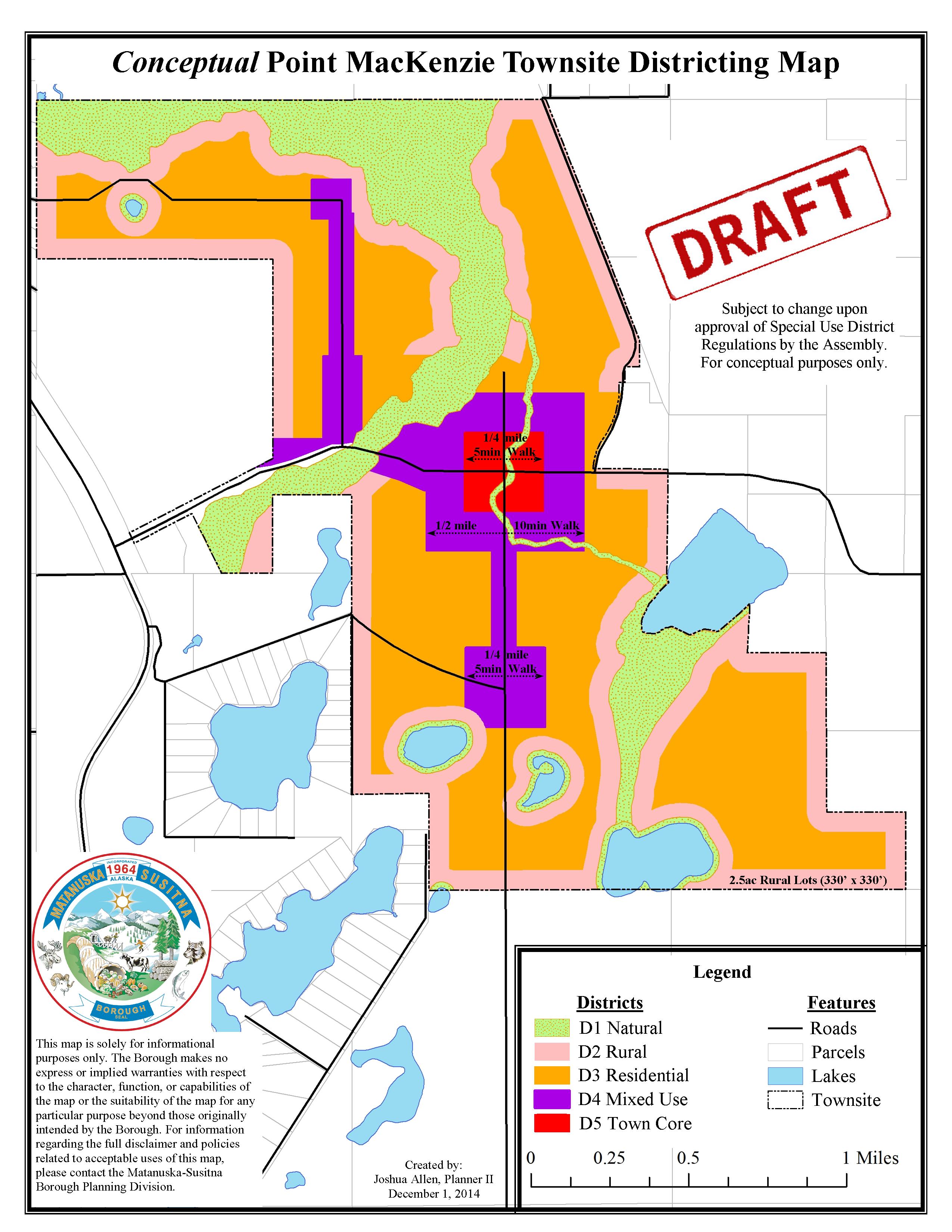
Point MacKenzie Townsite Resource Presentation
This comprehensive booklet highlights the various characteristics of the town site concept with pictures and multiple breakdowns of the conceptual master plan map. This presentation was used at a meeting with the Point MacKenzie Community Council on August 7, 2013.
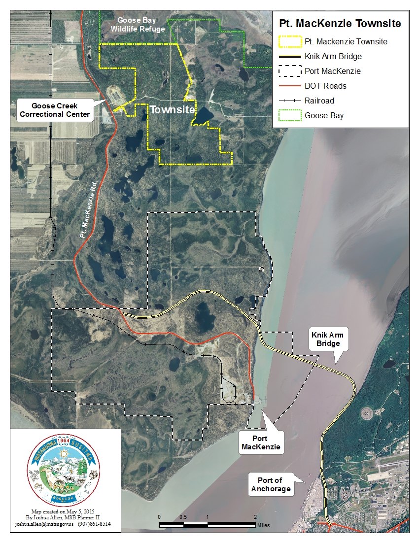
Point MacKenzie Townsite
 The MSB Assembly created the Point MacKenzie Townsite through Resolution 13-007 "in anticipation of, and as a demonstration of support for a bridge across the Knik Arm...supports layout, planning and development of town sites on public land adjacent to Alsop Road..."
The Knik Arm Bridge is a legislative priority of the Borough. It will provide access to developable lands for commercial, industrial, and residential uses. With over 60% of Alaska's population residing in the Matanuska-Susitna and Anchorage, comprising the largest and strongest regional economy, there will be an immediate development pressure as a result of the bridge in the community of Point MacKenzie.
In anticipation of the Knik Bridge, the Assembly identified as the townsite approximately three square miles of Borough owned land along Alsop Road adjacent to Port MacKenzie. With direction by the Assembly, multiple Borough Departments are collaborating on a master plan for the Point MacKenzie Townsite. These planning efforts will result in a modern city, focused on a pedestrian friendly main street and downtown core surrounded by mixed use and residential areas, within the identified townsite should the Knik Arm Bridge be built.
DRAFT Development Code
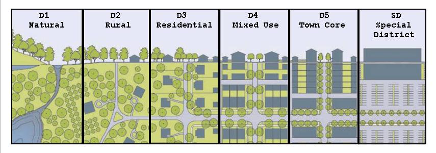
The draft Point MacKenzie Townsite Development Code provides form-based guidelines with minimum standards. This Code is required to develop a compact city with transitional districts. This type of development is focused on creating a walkable town with a Main Street and its own unique character.


There would be a transition from a rural area into a defined town edge that leads into a dense town core. An emphasis is placed upon the placement of buildings, streets, and civic spaces rather than land use. The purpose is to create a vibrant, walkable, mixed-use community with a high quality of life. The Code standards would only apply to the area within the Point MacKenzie townsite boundaries.
Public review of the first draft of the development code occurred July 31, 2014 to September 29, 2014. The development code is currently undergoing internal review and editing. It is anticipated that the second draft will be available for public review late summer 2015.
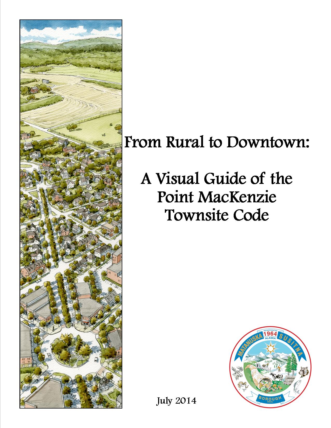
From Rural to Downtown
A visual reference provided for a better understanding of the draft Point MacKenzie Townsite Development Code.
The draft Point MacKenzie Townsite Code standards found in this brochure, if accepted by the Assembly, will assist with the development of the town site. As the Knik Arm Bridge becomes more of a potential reality, a plan needs to be in place to make the best use of available lands, and to create a traditional town in which people will enjoy residing in, recreating, and visiting.
Imagine many years from now, when then the area is developed into a town. Then into a full-fledged gateway city to the bountiful opportunities available in the Alaskan Interior. A city with attractive neighborhoods where people can live locally and feel part of a vibrant community. A city that attracts and supports a variety of residents, activities, and economic opportunities. If properly implemented, the Code, will fulfill that vision.
Support Documents
| Assembly Resolution Supporting Townsite Planning |
| Point MacKenzie Community Comprehensive Plan |
|
| Point MacKenzie Townsite Resource Presentation |
|
Maps
Public Comments
Event: Developer Focus
| On August 15, 2013 the Borough held an event for developers from the greater south central region to discuss the conceptual Point MacKenzie Townsite. The event was a luncheon that included a presentation and electronic survey session. The survey session was conducted by Information Insights of Anchorage. Attendees were used as a focus group for information specifically related to the town site’s viability and infrastructure needs. All of the event's general information and facilitation was provided by the Borough. MAT-SU Business Alliance acted as the event's host. In attendance were 12 developers, 3 members of the Point MacKenzie Community Council, 2 general members of the public, and various members of Borough staff. The presentation, invitee list, and survey results are all available through the links below: |
|
Floodplain Development and Information
Contact
MSB Permit Center
Phone
861-7822Federal Emergency Management Agency(FEMA)
Phone:
1-800-427-4661Website
http://www.fema.govRegulatory changes to flood insurance rates and subsidized policies, will affect MAT-SU Borough property owners living in a Special Flood Hazard Area. See the attached Biggert-Waters Presentation for more information.
A Flood Plain Development Permit is required prior to rebuilding or any other development within a Federally Designated Flood Hazard Area.
To determine if your project is within a Designated Flood Hazard Area please contact the Permit Center and request a “Flood Hazard Determination. Please provide the street address, subdivision name, lot and block, or the township, range, section, and parcel number.
If your property is located within the 100 year flood, there is at least a 1% chance each year the land may be subject to a "100 year" flooding event.
In an effort to reduce losses associated with these flooding events and reduce the amount of losses, the Federal Government, through the Federal Emergency Management Agency (FEMA), requires all structures to obtain Flood Hazard Insurance. To be eligible to receive Flood Hazard Insurance all new development must conform to the minimum standards of development as described in MSB 17.29 Flood Damage Prevention.
A complete application must include both the MSB Flood Hazard Development Permit and the Elevation Certificate. A Registered Engineer or Surveyor must complete the elevation certificate.
Management Studies
Flood Plain Management Studies
Damage and Prevention
Preparedness is the best way to be ready for a flood. Learn if your home is in a Flood Zone or accessed by crossing a flood zone. See our Emergency Preparedness site for how to be ready.
Attention Surveyors & MSB Residents
| Title | Link |
|---|---|
| FEMA Flood Insurance Study 2011 | |
| Insurance Federal Emergency Management Agency (FEMA) or 1-800-427-4661 |
Flood Damage Mitigation
| Title | Link |
|---|---|
| Be "FloodSafe"- Flood preparation and safety tips from FEMA. | |
| FEMA Flood Insurance Claims Handbook | |
| National Weather Service Advanced Hydrologic Prediction Service | |
| Red Cross Flood Preparation Site | |
| Shoreline Landscaping |
Mat River Erosion Study
The U. S. Department of Agriculture and the Natural Resources Conservation Service (NRCS) directed the study below. The study was conducted by MWH Global.
Flood Plain Mapping
![]() FEMA Flood Insurance Rate Maps (FIRMs) To help residents, developers, and planners better understand flood risks in our area, we provide access to both current and historical FEMA Flood Insurance Rate Maps. For the most up-to-date information, please visit the FEMA Map Service Center, which offers the latest interactive mapping tools and digital FIRM panels.
FEMA Flood Insurance Rate Maps (FIRMs) To help residents, developers, and planners better understand flood risks in our area, we provide access to both current and historical FEMA Flood Insurance Rate Maps. For the most up-to-date information, please visit the FEMA Map Service Center, which offers the latest interactive mapping tools and digital FIRM panels.
In addition, we’ve made available a selection of historical FIRM map sets for reference and comparison. These older maps can be valuable for understanding how flood zones have evolved over time and may be helpful in certain planning or research contexts.

