New floodplain maps in the Matanuska-Susitna Borough are the topic of discussion on Feb. 11, 6 p.m.-7p.m. in the Borough Assembly chambers in Palmer at 350 E. Dahlia Ave.
Northwest Hydraulic Consultants updated the 1985 Flood Insurance Study at the request of the U.S. Dept. of Homeland Security's Federal Emergency Management Agency. New Flood Insurance Rate Maps have been generated from the study. The revision shows the areas that would be inundated by a 100-year flood.
Basic changes include new geospatially referenced digital maps used with local geographic information systems. Updated topographic data and aerial photography were used to adjust floodplain boundaries. The maps also will use a vertical datum projection based on Mean Lower Low Water and follow a map panel layout based on the U.S. Geological Survey 7.5 minute quadrangle map grid.
These new maps will be used by lending institutions and insurance agents to help determine who must purchase flood insurance and the cost of that insurance. The MAT-SU Borough will use the maps for floodplain management purposes.
Those mostly affected own property or live in the identified flood hazard area. Please attend a meeting discussing the maps. Representatives from the Borough, the State, and FEMA will be available to answer questions.
For more information, call Pam Ness, Borough Code Compliance Officer, certified floodplain manager, at 745-9562 or This email address is being protected from spambots. You need JavaScript enabled to view it.
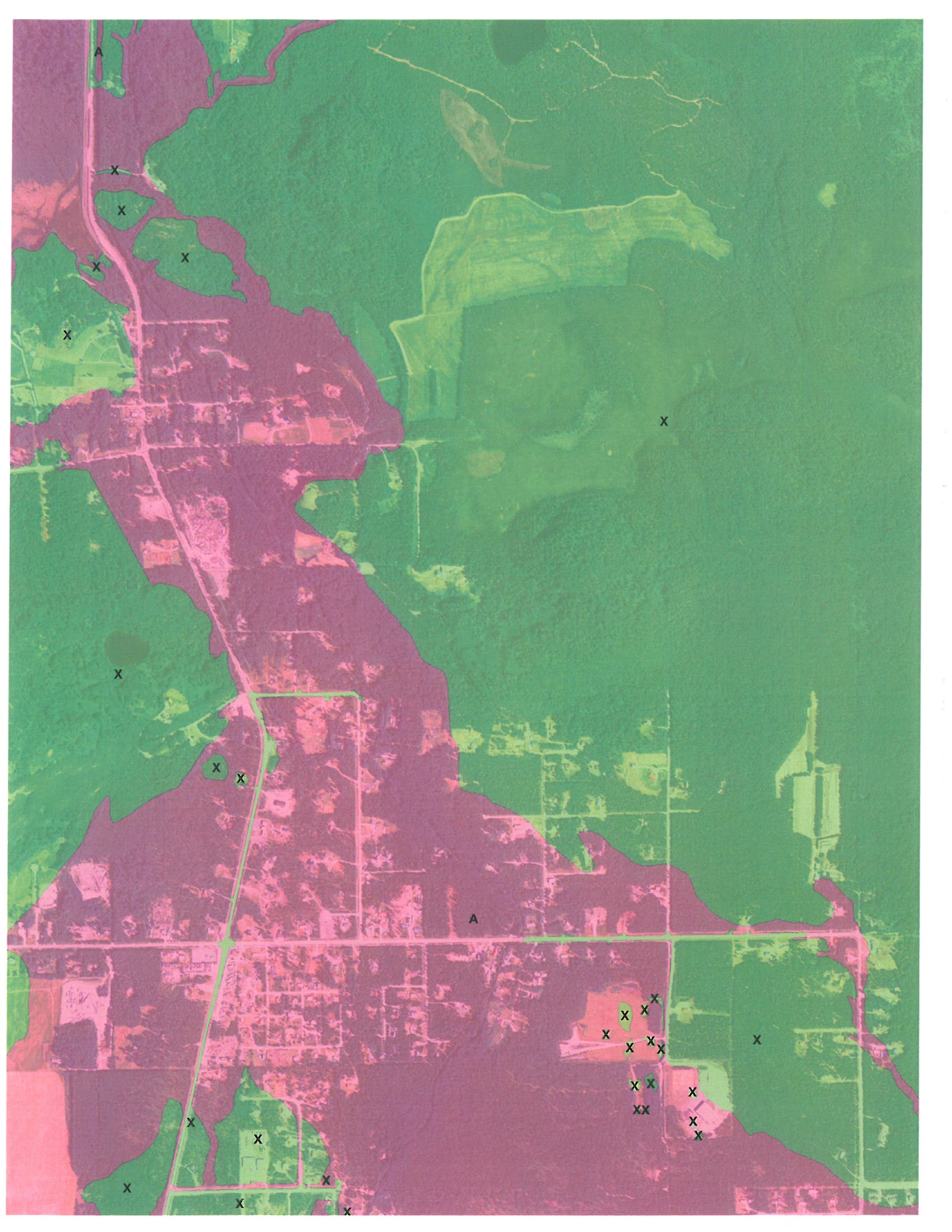
The image is an example of the floodplain maps, this one in the Butte. The maps are preliminary. The green areas indicate land outside the flood hazard area. The pink is land inside the special flood hazard area.
—End—