 MAT-SU— Beginning this spring, the Borough will be part of a multi-agency, $1.9 million project that puts planes in the air and adds accuracy to maps.
This week the Borough Assembly adopted the final legislation and appropriations from various partners for the acquisition of high resolution Light Detection and Ranging (LiDAR) and aerial photography data.
The area covered will include 3,500 miles of the MAT-SU Borough, which has never been mapped this comprehensively. This technology will bring the Borough into the 21st century with highly detailed information that governments, businesses and citizens will use to make decision for years to come. The new information is scheduled to be available in the public domain by early 2012.
Borough Assembly Member Mark Ewing called the technology “a good investment in the future.” Assembly Member Jim Colver has said, “the private sector will benefit hugely … and it will move the economy forward, which is what you want to do”.
More than 90 percent of the funding comes from a multi-agency partnership of Federal, State and non-profit sources.
Shannon Post, Borough Chief Information Officer of the IT Department, will manage the agreement with the contractor who gathers the data. The GIS Division will distribute the final products to all the partners and the public and incorporate the new data into Borough mapping and analysis projects.
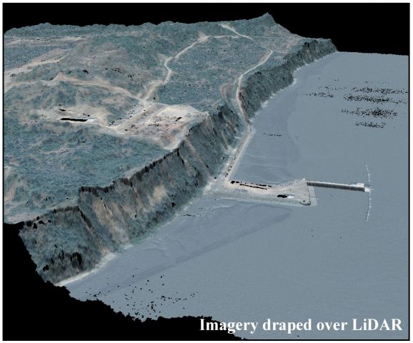
Post describes the technology, “LiDAR provides elevation information. The most widespread elevation data we currently have is from 1986 and is still being used to make decisions. LiDAR data is collected by sending signals from an airplane to the surface of the earth. When those signals bounce back up to the plane they provide detailed elevation information. Meanwhile other airplanes collect images of the earth’s surface. You can then take those two products and drape the imagery over the elevation to provide a detailed 3D model. Each product can be used on its own or combined together for problem solving and decision making.”
Click on player in upper right to listen to audio of Post.
The possibilities will be wide open with this new information. Among the many uses for elevation data:
- allows for better defined flood plain boundaries
- helps analyze properties for building site suitability
- provides data for 3D modeling
Among the uses for imagery:
- provides updated imagery for transportation planning
- improves 911 dispatch information for emergency response
The most recent imagery data is from 2004 and a lot has changed in the last 7 years, and our population has grown 50 percent in the last decade. The most recent elevation data dates to 1986 and covers only 235 square miles with five-foot contours. A contour is a line representing a particular elevation. The new data will provide two-foot contours as well as a one-meter digital elevation model across the entire project area. This provides a more detailed look at landscapes.
Project Partners include the Bureau of Ocean Energy Management, Regulation and Enforcement (BOEMRE) Coastal Impact Assistance Program (CIAP); United States Geological Survey (USGS); Alaska Industrial Development and Export Authority (AIDEA) - Alaska Energy Authority (AEA); United States Fish and Wildlife Service (USFWS); The Nature Conservancy (TNC); National Oceanic and Atmospheric Administration (NOAA); MAT-SU Salmon Partnership; and the Matanuska Susitna Borough (MSB).
For more information call Borough CIO, Shannon Post at (907) 745-9570 or This email address is being protected from spambots. You need JavaScript enabled to view it.
—End—
